In Search of the Big Picture – a Green Map for more effective conservation efforts in the Creston Valley
By Yann Troutet on 2020-01-20 00:00
Saving Wilderness! It has long been a motto of the conservation movement. But how? And where? Sure: anywhere and by any means is better than just talking about it. But what if you could find a way to conserve those areas that matter the most? And what if very little real ‘wilderness’ is left around you? These are questions that conservation advocates struggle with all around the world.
This is a Guest Blog Post by Yann Troutet, our at-the-time Coop and now Remote Sensing Instructor in ADGIS
“I think it is far more important to save one square mile of wilderness, anywhere, by any means, than to produce another book on the subject.”
— Edward Abbey, Postcards from Ed: Dispatches and Salvos from an American Iconoclast
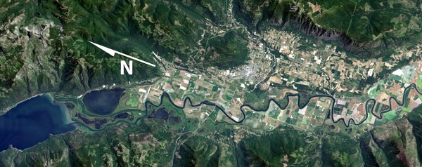
This project’s study area is centered on the Creston Valley (see figure 1). Nestled between the Purcell and Selkirk mountains ranges, this valley boasts a remarkable network of wetlands and varied forest ecosystems. It offers hospitable winter climates and is found at the crossroads of major wildlife and biodiversity movement corridors. However, as is the case in many of BC’s valley bottoms, the Creston Valley’s natural habitats have been deeply affected by human development.
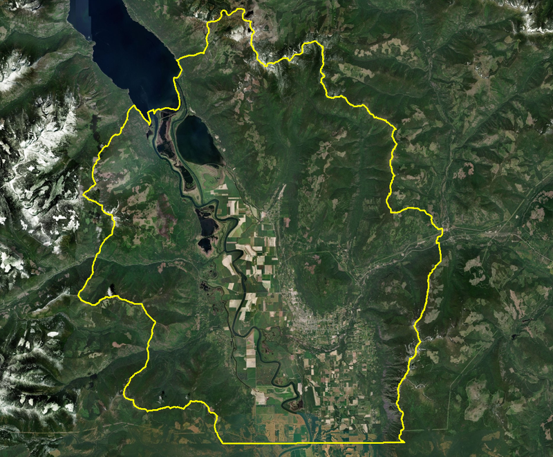
Figure 1: Centered on BC’ Creston Valley, the Green Map’s study area reaches up into the alpine following the valley’s watershed boundaries and ridgelines.
Wildsight’s Creston Valley chapter is a grassroots organisation committed to large-scale conservation, sustainable community initiatives and environmental education. In order to guide its conservation action, Wildsight is seeking a big picture view of the Creston Valley’s most critical habitats and corridors. The organisation mandated the SGRC to address this challenge. This became the subject of my GIS coop internship.
Having some experience in resource conservation, but being new to BC, I am grateful that this internship is getting me acquainted with the many large geospatial datasets produced by the provincial government to help inform our understanding of the world around us. I have been diving deep into the laden universes of Vegetation Resource Inventories (VRI), Predictive Ecosystems Mapping (PEM), Biogeoclimatic Ecosystem Classification (BEC) and the like.
In all, I have compiled over 40 data sources to help inform this ‘big picture’ view. The project breaks this down into ten themes: habitat rarity, wildlife values, human footprint constraints, viewscapes, etc. Inspired by suitability modelling, I propose a detailed map for each theme, where ranking systems highlight those areas in the Creston Valley that have high value for the given themes. In the examples below, the results highlight:
1) the parts of the study area that have the most unusual natural attributes, based on information sources such as the VRI, PEM and BEC datasets (figure 2);
2) the most visible elements of the landscape, based on a combination of visibility analyses and land management objectives (figure 3).
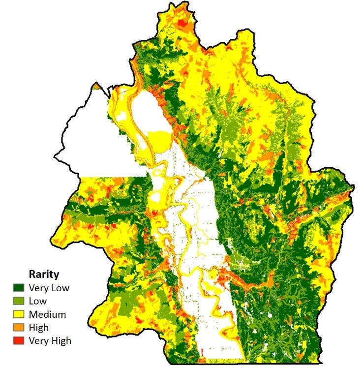
Figure 2: Generalized values for the Creston Valley Green Map’s ‘Rarity’ theme
Figure 3: Output values for the Creston Valley Green Map’s ‘Viewscape’ theme (areas displayed in red are the most highly ranked overall)
Using my newly acquired skills to produce the theme outputs was gratifying. But, as a life-long conservationist, I get excited even more is when opportunities arise to improve the outcomes of conservation efforts. On this front, one of the hottest avenues in conservation GIS is connectivity modelling.
A place like the Creston Valley provides an ideal context for connectivity restoration studies. And it’s all about the Where... Building on circuit theory, connectivity modelling leverages the power of GIS to identify pinch points and pathways for biodiversity movements over landscapes. For the Creston Valley, I am using the outputs of my theme maps to model the linkages that would be the most effective at reconnecting highly ranked habitats. As an example, I have run a test that attempts to find the ‘least cost’ pathways connecting both sides of the valley (figure 4). Although there are many assumptions that must be taken into account in such an exercise, it is interesting to examine its results and to reflect on the ways that this can help restore effective natural corridors on the land.
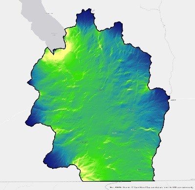
Figure 4: Results of preliminary connectivity modelling (areas displayed in bright tones offer potential ‘least cost’ pathways for ‘biodiversity movements’ across the landscape)
Results such as the above will soon be summarized and handed over to Wildsight, in the hopes that these will help guide conservation work in the Creston Valley. Sharing and discussing the results with local stakeholders and governments will be the next step, and a key short-term outcome of the project.
Needless to say, I will be happy to help carry the message.
“In the end we will conserve only what we love; we will love only what we understand; and we will understand only what we are taught.”
— Baba Dioum, 1968